Open-air Laboratory
Greece
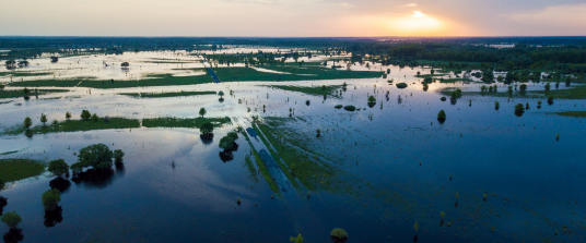
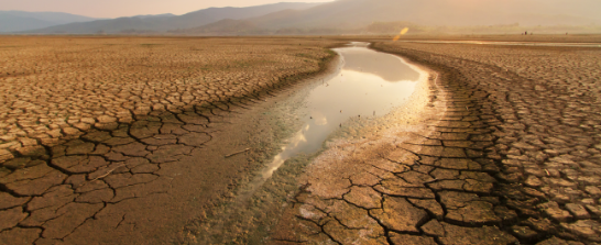
The Greek OAL is located in the basin of Spercheios river, in Central Greece. It springs from the mountainous parts of the catchment. Heavy rainfalls cause flows exceeding its banks resulting in regular flood events. During the summer months, due to strenuous irrigation of agricultural land, the area also faces water scarcity. Agriculture is the most important means of living in OAL-Greece even though forests and semi-natural areas cover more land than agricultural areas. Several small villages are located in the OAL Area.
Greece
The River is recharged by many streams of permanent and periodic flow and discharges in Maliakos Gulf. The steep slopes, which are present within approximately 2/3 of the total length of the river course, form a rather mountainous topography (streamy with crucial flooding peaks and very intense sediment yield). Only in the last downstream part of Sperchios course, the topography gradually changes into a lowland relief. The catchment area has an extent of approximately 1700 km2 and a mean altitude of 640 m with a maximum height of 2285 m. Half of the basin is plains and hills, with an elevation lower than 600 m, whereas a 20% is semi-mountain (600-900 m) and 30% mountain (above 900 m).
Motivation for choice according to hazard exposure and asset value
Solutions
Two Natural Water Retention Measures (NWRM) in two different parts of the river that comprise restoration and stabilization of the riverbanks, cleaning the riverbed sedimentation, widening of the riverbed and modifications to the existing nearby hybrid measure, that was built to regulate the water flow. The result is similar to an on-line water reservoir construction. The solutions were co-created with several local stakeholders’ groups through the whole duration of OPERANDUM.
To learn more about the Greek OAL please visit the interactive page with detailed information regarding the hazards they face and how NBS is providing solutions.
Our partners
Hazards
Across the world, we are facing challenges like disaster risk everyday. Some of us are living in areas where disasters are very likely. Which challenges are you facing in your area? Flood, landslides, coastal erosion, drought, something else?
Flooding
The fear of flooding is a major perceived risk. Floods affect many areas, such as agriculture, infrastructure, local businesses as well as the tourism sector. To deal with the risk of flooding, OPERANDUM has implemented multiple Nature-based Solutions.
Contact
Have a question, feedback or want to work with us?
